Jillian French – News Editor
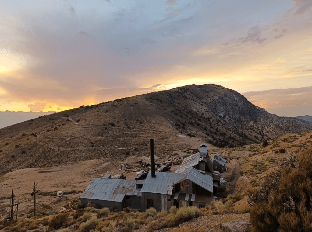
Photo courtesy of Henry Mitchell
During the summer, four members of the Bishop’s community geared up for a trip to the historic Cerro Gordo Mines in California. The group was led by Professor Bruno Courtemanche and Dr. Elisabeth Levac from the department of environment, agriculture and geography (EAG). The professors, along with students Henry Mitchell and Rhodric Anselmo Mendoza Hayward, descended into the abandoned silver mines to map the 48 kilometers of underground tunnels. The team used advanced lidar technology to create a 3D map of the mines, preserving history by creating public digital access to the site.
The Cerro Gordo area was given its name by Mexican prospectors, who discovered the silver in the ground. By the mid-1800s, the area was well-established in the Wild West, with over 48 kilometers of tunnels expanding from the 900-foot elevator shaft. Just as quickly as it sprang up, the mine was abandoned in 1877 when a fire wrecked much of the underground infrastructure. The area was mined briefly for zinc in the early 1900s but remained otherwise empty until its 2018 purchase by entrepreneur Brent Underwood. Underwood hosted the Bishop’s expedition, and their venture will feature on his YouTube channel Ghost Town Living.

Photo courtesy of Henry Mitchell
Once in California, the group ventured each day 86-400 feet down the elevator shaft to begin their daily work. Using lidar technology, 3D laser scanning, the group methodically marked and scanned areas to stitch the scans together, ultimately creating a comprehensive 3D map of the underground tunnels. Dr. Levac stated that “there have been maps done in the past, but people didn’t have the tools we have today”, adding that the group was able to add unmapped tunnels, fix directional inaccuracies and create a complete scan of the area. Their daily work included moving the scanner along the galleries, working the computer and running the tech back and forth. They also used drone photogrammetry to map the surrounding landscape above ground. Henry Micthell and Dr. Levac described the physical challenges of working in a remote environment, from lower oxygen levels to unexploded dynamite.
For the students, preparation for the trip included taking the geographic information system and remote sensing course during their studies at Bishop’s, which introduced them to the technology. Mitchell also said that the group “traveled to an abandoned copper mine to get a sense of what the equipment looked like” in preparation. However, he added, “Most of the learning was on the spot… the first few days were overwhelming, but by the end we had found a really good rhythm”. For Dr. Levac, preparation included planning and packing equipment, as well as preparing herself for physical challenges: “I tried to walk a lot to prepare before going. The high altitude makes you short of breath, and you wake up all the time at night because your brain thinks you’re short on oxygen”. Like Mitchell, she found that “you plan as much as you can, but then you have to adjust, just like any mission”.
Once completed, the maps will be publicly accessible. Mitchell stated that it was “important to create something that visitors can see”. The trip allowed both him and Dr. Levac to visualize how the miners would have lived and worked on the site over a century ago. As a venture into experiential learning, Mitchell also enjoyed the chance to “experience what fieldwork is”.
The group returned from the trip on Jul. 29, having successfully scanned and mapped the abandoned silver mines. The trip highlights the rich experiential learning opportunities in the EAG department at Bishop’s. Additionally, it underscores the possibility of using advanced technology to preserve historical sites.
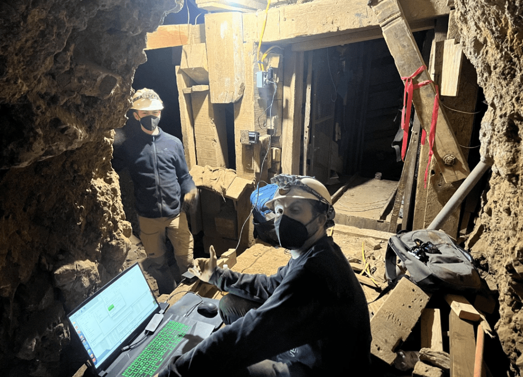
Photo courtesy of Henry Mitchell